URLs
Search and Rescue
http://dl.dropbox.com/u/17428269/SUAS-COTT_31May2012%20slides.pdf
http://www.hstoday.us/industry-news/general/single-article/exclusive-dhs-small-drone-test-plan-calls-for-evaluating-sensors-for-first-responder-hs-operational-communities/85fbd03243c8559e42ddaaaf324f84c7.html
http://www.theverge.com/2013/5/10/4318770/canada-draganflyer-drone-claims-first-life-saved-search-rescue
Intl Development, Refugee camps, mapping
http://www.openrelief.org/home/
http://www.droneadventures.org/
Discussion: http://gis.19327.n5.nabble.com/UAVs-td5769891.html
Human RIghts
http://www.nytimes.com/2012/01/31/opinion/drones-for-human-rights.html?_r=0
Conservation Antipoaching
conservationdrones
Equipment:
FPV Transmitter receivers
FPV goggles
Cameras
Sensors
Gimbals
Fixed wing airframes
Multicopter airframes
Motors
Batteries
Mapping
2d, stitching
3d, pointcloud
complete systems
Notes from call with area fire chief
Do an exercise and capture video
virginia firechiefs association
Host a webinar or forum
Discuss value prop
how move this forward
VDEM
North Anna nuclear
Contact another fire department: Roanoke David Hopack
Dr. Griffin, is a former fire chief in loudon
Some notes from meeting with CAP
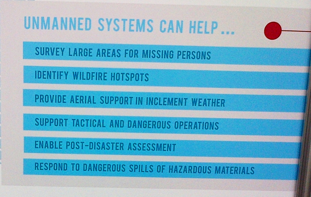
Some of the ideas that elicited the greatest interest included helping ground teams see around the sides of cliffs, carrying specialized sensors that may be able to detect toxic chemicals in an area where there may be a leak, helping search around a body of water that may be difficult to traverse, providing communication repeaters in the sky, and holding a camera stationary in the air while connected to a power source to allow for unlimited flight time. Mounting a ELT direction finder on a quad to aid ground teams to rapidly hone in on the location of crashed aircraft. CAP pilots fly their aircraft no lower than 1000 ft AGL with an ELT direction finder and can mark the location of a ELT to within 1/2 mile. This position is passed to the ground team who uses a handheld direction finder to actually locate the downed aircraft. This could be in a wooded area and may take some time to actually locate the downed aircraft. Having a ELT direction finder on a quad flying above the trees could be used to hone in on the exact ELT location much faster in these situations. Another possible use would be using a quad to locate other emergency beacons, such as avalanche beacons.